
Georgetown Block Source Records
The public record around a Georgetown Township block is made of parcels, not a household roster. Ottawa County’s GIS viewer connects an address or parcel to a property summary and deed search. The property roll adds the assessed owner, physical property address, tax mailing address, legal description, parcel number, values, sales, and split history. A deed can name parties to a recorded transfer. Each source answers a narrower question. An owner can be a trust, estate, business, or a person who receives tax mail elsewhere, so none of these records alone proves who occupies a home.
| Block source | What it can show nearby | Access route |
|---|---|---|
| Ottawa GIS parcel viewer | Parcel shape, adjacent lots, PIN, owner and address popup, map layers | Public map, query, selection, and parcel links |
| Ottawa Property Search | Assessed owner, situs and mailing address, legal description, sales and split history | Owner, parcel, or house-number and street search |
| Register of Deeds | Grantor, grantee, recording date, document, parcel, and related documents | Free index; images cost $1 per page plus a convenience fee; counter and research library are alternatives |
| Qualified Voter File channels | Permitted voter-file data in an authorized, defined geography | Formal request, not a public block browser |
| Community resources | Organization contacts, local history, public programs, and historical affiliation clues | Library, historical association, chamber, township board, and published materials |
Start with the smallest reliable unit, the individual parcel. Maintain separate columns for assessed owner, situs address, and mailing address. A shared mailing address can simply mean one owner receives correspondence for several parcels. A repeated name, a PRE flag, or a shared street also does not turn property data into a household list. Note: Record the search date because local units update owner names and addresses in the county system.
Map Georgetown Parcels by Block
The county’s adjacent-parcel method begins at parcel scale. Search the exact address or PIN, turn on address and parcel labels, and click the subject polygon. Record its FinalPIN, frontage, property address, mailing address, legal description, government unit, and subdivision clues. Then click the parcels that share a boundary or face the same street segment. The public configuration documents query and CTRL-click selection for multiple map objects, but it does not document a one-click radius or buffer report for nearby parcels. A manually defined study area is more transparent than treating a circle on a map as an official boundary.
- Locate one address in Ottawa GIS and capture the returned FinalPIN exactly as displayed.
- Click each adjacent parcel or use CTRL-click to add it to the selection panel.
- Compare the situs, mailing, legal-description, lot, subdivision, and owner fields without merging them into one household claim.
- Open Property Summary or Deeds Search from the parcel popup when a recorded transfer or split needs confirmation.
- Ask the custodian to inspect or correct a public record if the parcel or address does not match the underlying file.
For a view of the tools and layers, use the Ottawa County property mapping service.
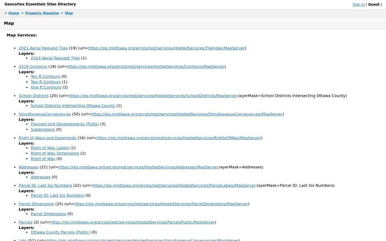
The map’s parcel, address, subdivision, road, school-district, building-outline, jurisdiction, and aerial layers help orient a block, while a deed or property file supplies the record behind a selected parcel.
Georgetown Block GIS Layers
Ottawa GIS makes the block understandable as legal geography. Its visible layers include parcels, addresses, parcel-ID labels, parcel dimensions, roads, rights-of-way, easements, subdivisions, lots, sections, quarter sections, jurisdiction outlines, school districts, building outlines, aerial imagery, and public parcels. The parcel popup may show FinalPIN or parent and condo PINs, OwnerName, property and mailing address components, LegalDesc, GovernmentUnit, PropertyClass, PrincipalResidenceExemption, acreage, and a latest-sale link. The map polygon is useful administrative evidence, but it is not a legal survey.
Turn on lots and subdivisions when an address seems to cross a development line. Turn on rights-of-way and easements when a question concerns access rather than ownership. School-district and jurisdiction layers explain why a Georgetown Township property can carry a Jenison postal label or another service boundary. Measurement tools can support orientation, but their distance, area, circle, or shape outputs should never be offered as a surveyed line. The exact PIN is the durable bridge from a map popup to property, tax, and deed records.
Georgetown Block: Situs and Mailing
Three address ideas need to stay separate in a Georgetown Township block search. The situs or property address is the physical parcel. The mailing address is the destination used for tax correspondence. The legal description is the deed-defined land, often a subdivision lot and block or public-land-survey description. A parcel owner may receive mail in another city or state. The property field can also name a business, trust, estate, or LLC. Those records can explain ownership and correspondence, but they cannot identify every resident at the property.
PRE is another limited signal. Georgetown’s FAQ says the Principal Residence Exemption requires ownership and occupancy, so it can be relevant evidence about an owner’s qualification. It is not a census of everyone at an address. This distinction prevents a common error in neighborhood research: a ZIP result, parcel owner, mailing address, or PRE indicator does not prove a household composition. When an address is disputed, preserve the returned PropertyAddress, MailingAddress, GovernmentUnit, legal description, and date as separate facts.
Georgetown Neighbor Voter Limits
Michigan’s Voter Information Center is an individual self-service tool, not a street roster. A successful self-check can show registration status, polling place, sample ballot, clerk, ballot-subscription information, absentee status, and early-voting information for the requester. Its name mode requires first name, last name, birth month, birth year, and ZIP; it also has license and address modes. A no-match or multiple-match result directs the person to correct the search or contact the clerk. It does not provide a public way to browse every person on a Georgetown Township block.
A broader Qualified Voter File request uses a formal Michigan process that selects one defined geography, such as a jurisdiction, county, district, school area, ward, or precinct. Permitted data can include name, residential and mailing address, year of birth, registration date, voter status, voter ID, and history. Driver-license or state-ID number, month and day of birth, phone, email, digitized signature, and the last four digits of a Social Security number remain exempt under MCL 168.509gg. Contact the township clerk or the Bureau of Elections for scope and cost details, rather than treating a precinct request as a neighbor lookup.
Georgetown Neighbor Community Contacts
Community resources provide public contacts and historical context, not private member lists. The Jenison Historical Association maintains the local-history room with the public library and offers museum, newsletter, school, and township-memory connections. Georgetown Township Public Library supplies public programs, local-history volunteers, and genealogy databases. The Grandville Jenison Chamber publishes a member database with organizations and businesses, including Georgetown Charter Township, Jenison Public Schools, churches, funeral homes, veterans organizations, and Wallinwood Condominium Association. A member listing is an organizational affiliation clue, not a resident directory.
| Jenison Historical Association | History room, museum, newsletters, and local research contact. P.O. Box 664, Jenison; 616-457-4398. No member-address directory was located. |
|---|---|
| Georgetown Township Public Library | Public programs, history-room volunteers, and genealogy resources. 1525 Baldwin Street, Jenison; 616-457-9620. |
| Grandville Jenison Chamber | Public member and organization listings. 2990 Franklin Avenue, Suite 114, Grandville; 616-531-8890. |
| Township board and committees | Public agendas, meetings, and civic contacts by issue. They are not neighborhood membership rosters. |
For published township staff and department contacts, use the Georgetown Township staff directory. It has category, first-name, and last-name controls, although its individual entries may require a browser with scripts enabled.
Georgetown Block Plat Context
Plats and legal descriptions are the right path when nearby parcels share a subdivision name, condo parent PIN, easement, or lot boundary. Ottawa’s Plat Search accepts a plat name, and the resulting PDFs can bridge a street address to a lot and block. The Register of Deeds index can then be searched by parcel, name, liber and page, or document instrument number. Its visible results include Record Date, Party 1, Party 2, Doc No, Doc Type, Liber and Page, Parcel No., and Related Doc. Search the current seller as a grantee to move backward through a recorded ownership chain.
Split History is especially important when an older address search is empty. The county documents parent and child parcel history back to 1975. A historical parcel can be inactive after a split or combination, even though the land remains in the same area. The GIS popup links to Property Summary, Deeds Search, and parcel-error reporting. That connection is an insider shortcut: keep the FinalPIN and legal description together so the same parcel can be checked across the county tools. Note: Document images can cost $1 per page plus a convenience fee, while the index search is free.
Georgetown Neighbor Tools Compared
Official sources and commercial neighbor-search products do different things. An official parcel, deed, or voter-file channel identifies the custodian, fields, access limits, and date of the underlying record. Commercial tools may combine public-record feeds, marketing data, and user-contributed information. They can retain old addresses or merge same-name people. Use a commercial result, if encountered, only as an unverified lead and confirm it with the office that keeps the original record.
| Source type | Best use | Key limit |
|---|---|---|
| County GIS and property records | Identify adjacent parcels, assessed owners, legal geography, and address fields | Owner and mailing data do not establish household membership. |
| Recorded deeds and plats | Verify a recorded transfer, lot, subdivision, or easement | The index and image have access differences; a record is not a current occupancy claim. |
| Commercial neighbor-search category | Generate a lead for later verification | May be stale, incomplete, or mix records for people with the same name. |
If a county result is wrong, use the GIS error link, the assessor or local unit, the Register of Deeds, or the court or clerk that holds the source record. A copied screen or third-party listing cannot change an official file. Ottawa County’s online FOIA tracker, counter service, mail, fax, and in-person channels are additional routes for non-exempt records that are not available in a portal.
Georgetown Neighbor Privacy Limits
Important information remains outside a block search. Public property data does not name non-owner occupants or every household member. Utility and delivery accounts are not resident directories. Federal DPPA rules restrict personal DMV data. Michigan voter-file exemptions protect driver-license and state-ID numbers, birth month and day, phone, email, signature, and other listed fields. Juvenile, sealed, expunged, adoption, protected-person, and other court records may be omitted. Private HOA, church, school, club, and member rosters are not presumed public.
Lawful use. Use Georgetown Township neighbor records for personal research, property context, civic questions, or family history. Michigan stalking laws prohibit repeated harassment, threats, surveillance, or conduct intended to frighten or harm another person.
Michigan’s Address Confidentiality Program provides a substitute address and mail forwarding for qualifying participants at risk of harm. It is not a general deletion service, and the protected address should not be pursued through voter, parcel, or DMV workarounds. A person seeking correction should contact the custodian, follow its amendment or correction process, and retain the response. The Michigan Address Confidentiality Program explains its qualifying and advocate-based process.