
Finding Georgetown Township Street Directory Records
A street-by-street search works best as a chain, not as a claim that one screen proves a household. Start with the exact address in the county property system. Its result gives the parcel identifier, property address, assessed owner, tax-mailing address, legal description, sales and split history. Then use the GIS map to see the parcel in context and to open links back to the property and deed systems. The deed index establishes recorded transfers. Historical street-order directories and census records can add a dated household clue when they exist. A voter self-check is not a public street roster; broader voter-file access follows the formal Michigan request route.
- Verify the address with the USPS ZIP Lookup. A postal result confirms delivery information, not that a named person is present.
- Run the house number and street name through Ottawa County Real Property Search. Include inactive parcels if an older address seems to have disappeared, and write down the FinalPIN exactly as returned.
- Open Ottawa County Property Mapping. Turn on address and parcel labels, click the target polygon, and compare the property address, mailing address, legal description, subdivision, and government-unit fields.
- Follow the parcel or owner into the Register of Deeds index. Read the current transfer, then search the seller as a grantee to move backward through ownership.
- For a dated occupant lead, ask the Georgetown Township Public Library history room, the Jenison Historical Association, or the Library of Michigan about Polk or Bresser street-order volumes. Pair any hit with a census, tax, deed, or obituary record.
Georgetown Township assessing services have been provided by Ottawa County since June 2024. That makes the county property search and GIS map the practical first stop, while the township can clarify local building and zoning files. The same address may carry a Jenison postal city, Georgetown Charter Township government unit, and Ottawa County custodian. Preserve all three labels rather than forcing them into one name.
Georgetown Township Address Fields That Matter
The Ottawa County property search has three useful paths: owner last name, parcel number, and house number with street name. It does not show a basic ZIP filter or a street-only browse button. Repeating exact address searches is more reliable than issuing a broad street query. The return can contain both active and inactive parcel choices, which matters when a split, combination, condo unit, or older PIN interrupts the trail. Check the property record’s update context before treating it as current.
| Property search field | Input | Required | Street-directory use |
|---|---|---|---|
| Owner Last Name | Text | Not marked | Find assessed parcels under an owner name. |
| Active / Inactive Parcels | Choice | Optional | Catch an older or changed PIN. |
| House Number | Number | Not marked | Begin an exact by-address search. |
| Street Name | Text | Not marked | Pair with the house number; no street-only button is shown. |
| Parcel number segments | Segmented number | Not marked | Carry the precise PIN across the map, tax, and deed records. |
A situs address is the physical parcel address. A mailing address is where tax correspondence goes, which may be another city or state. A legal description is the deed-defined land description, often a lot and block or public-land-survey description. These fields complement one another. They should not be substituted for a current household list.
Note: An owner may be a trust, estate, business, or nonresident, so the property result identifies an assessed ownership interest rather than every occupant.
Georgetown Township GIS for Street Segments
Ottawa County Property Mapping turns one address into a readable street segment. Search by address, parcel ID, or owner name, zoom to parcel scale, and use the map query to inspect one feature. The map exposes parcels, addresses, parcel-ID labels, lots, subdivisions, roads, rights-of-way, easements, jurisdiction outlines, school districts, building outlines, and aerial imagery. Clicked parcel popups link to Property Summary, Deeds Search, and a parcel-error report route.
The map can also select multiple features with CTRL-click. That is useful for comparing parcels along a Georgetown Township street, but it is not an official radius report or a legal survey. Use measurement tools only for orientation. A boundary line, access issue, or parcel mismatch belongs with the appropriate county or township office, not with a screen measurement.
For the county property system, start with the address search interface shown below. It makes the separate owner, parcel, and address routes visible before a street search begins.
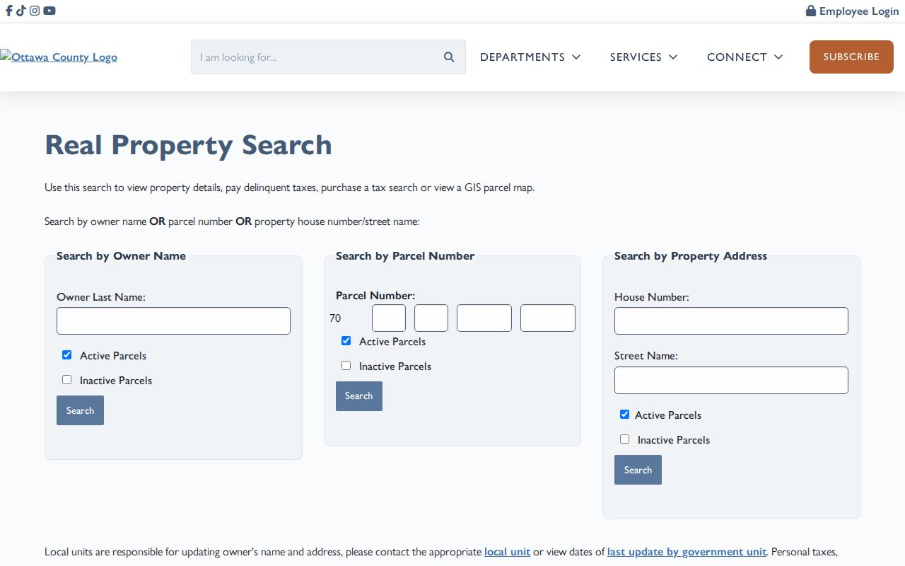
The displayed fields support an exact number-and-street workflow. Keep the returned PIN and legal description with the address notes so later deed and GIS results can be compared without guessing.
Georgetown Township Street Directory Sources
Each Georgetown Township street record answers a different question. The parcel roll identifies assessed ownership and land data. GIS supplies parcel geography. Deeds show recorded transactions. Permits can date work, and historical sources can show a person or taxpayer in a particular era. The access path changes with the source. A portal result is only the first channel when a record is older, missing, or needs inspection.
| Address-keyed source | Custodian | What it can show | Ways to access it |
|---|---|---|---|
| Property summary | Ottawa County Equalization and local unit | Owner, PIN, situs and mailing addresses, legal description, values, PRE, sales and splits | Public miOttawa search; county or assessing call for clarification |
| Parcel map | Ottawa County GIS | Parcel shape, PIN, adjacency, map layers, owner/address popup | Public mapping viewer and query tools |
| Deed index and image | Ottawa County Register of Deeds | Grantor, grantee, record date, document number, type, liber/page, parcel, related documents | Free online index; image at $1 per page plus convenience fee; counter and research library |
| Plat and subdivision record | Register of Deeds and GIS | Plat name, lot, block, subdivision, and legal geography | Plat Search, PDF records, GIS layers, and deed research |
| Building or zoning file | Georgetown Township and Professional Code Inspections | Application, project, review, and inspection chronology | Request by address or PIN, paper process, or FOIA; no public permit database was located |
For material outside the portal, call the Register of Deeds at 616-994-4510, inspect records at the Grand Haven research library or county counter, and ask for historic books or microfilm if the online result ends. County FOIA requests use the Ottawa FOIA Center, which requires an account for online submission. A requester can also ask the custodian first, seek inspection before copies, and specify name variants, parcel, address, record type, and date range.
Follow a Georgetown Township PIN Into Deeds
The PIN is the durable bridge between a modern street address and the deed index. In the miOttawa Register of Deeds search, search the parcel first and then try the owner or business name. The index permits last or business name, first name, recording-date range, document type, liber and page, instrument number, and five parcel segments beginning with 70. Results are limited to 200, so date ranges should stay small. The results table provides record date, Party 1, Party 2, document number and type, liber and page, parcel number, and related document.
Recorded ownership work moves backward from the current purchase. Read the transfer document, identify the seller, then search that seller as a grantee in an earlier period to find the prior purchase. Keep the legal description in view because address labels can change while the land description connects the older record. The online screen does not publish an earliest coverage year. When the index stops, use the county research library, counter terminal, historic deed books or microfilm, Archives of Michigan land records, and plats instead of assuming the trail has ended.
The county deed index separates a free index search from document-image access. The tabs below illustrate the name, date, liber/page, instrument, and parcel routes.
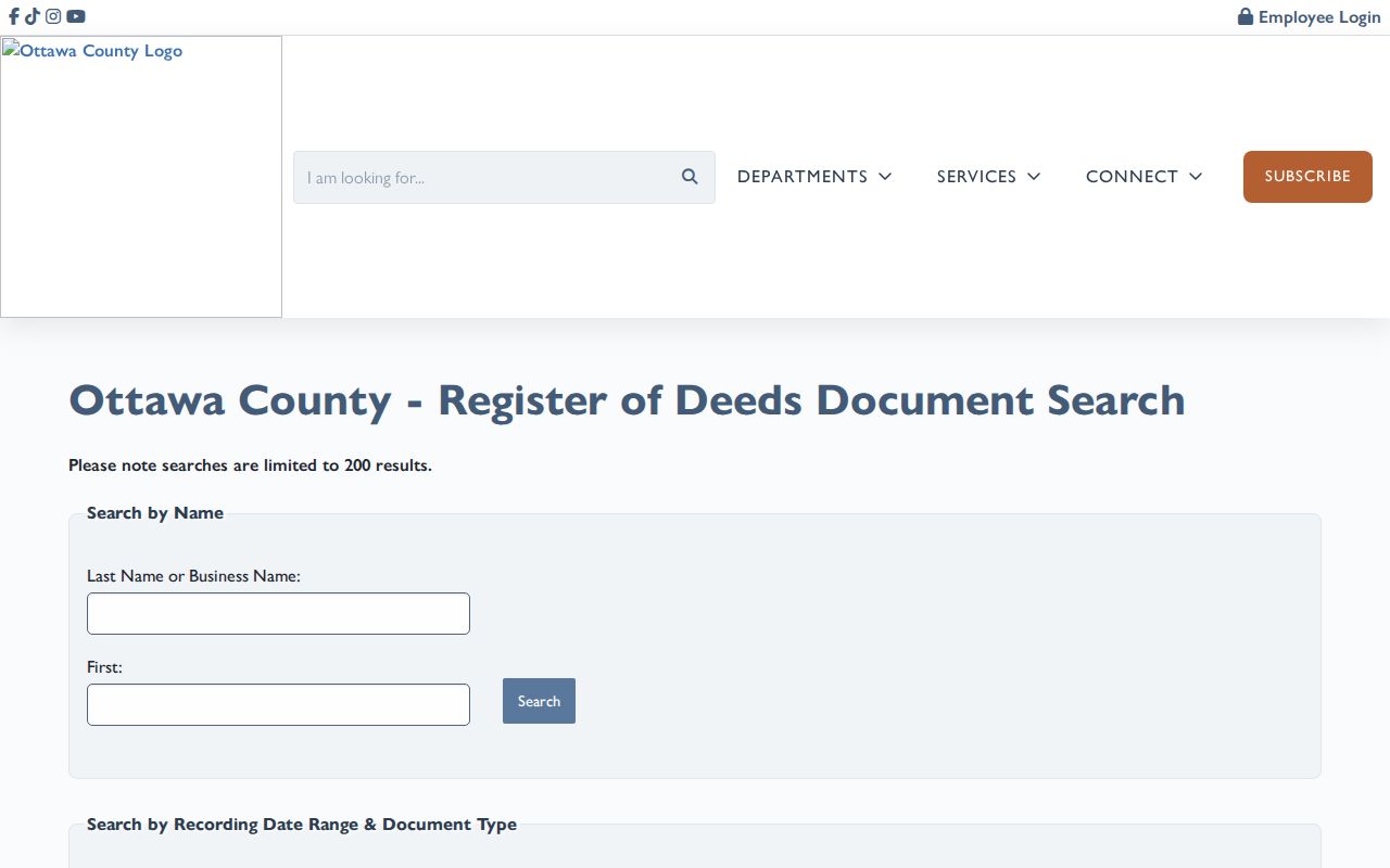
Document images cost $1 per page plus a convenience fee, and instrument numbers containing the letter U do not have an image. The index still supplies useful identifiers for an in-person or archival follow-up.
Georgetown Township Streets Across Older Labels
A Georgetown Township address may appear under more than one place name. Jenison is an unincorporated community inside the township, and older material can use Jenisonville, Georgetown Township, Jenison, South Georgetown, or a nearby community label. The public sources did not establish a township-wide street-renumbering project or date. Search street-name variants, old numbers, plats, the legal description, and PLSS section or range rather than inventing a renumbering explanation.
For historical occupants by address, Polk volumes arrange streets alphabetically and names in house-number order. Bresser criss-cross volumes can add telephone, tenure notation, first-listed year, arrival, and move notes. Georgetown’s local-history page names directories but does not publish a verified local year-by-year run. The Library of Michigan guide, its print and microfilm rooms, online institutional databases, and an Ottawa County 1903-1921 regional catalog lead are the right places to check coverage volume by volume. The historical collections have a fuller treatment in the Georgetown Township city directories.
- Parcel
- A defined piece of land recorded in the county property system and identified by a PIN.
- Situs address
- The physical address attached to the parcel, distinct from the tax-mailing address.
- Plat
- A recorded map that lays out a subdivision’s lots, blocks, streets, and related legal geography.
- Criss-cross directory
- A reverse directory arranged by street and house number, often listing a head of household or business.
Georgetown Township GIS Links for Block Work
The most useful local shortcut is inside the GIS parcel popup. After an address query, its links can move from the selected map feature to Property Summary, Deeds Search, or the county’s parcel-error channel. That keeps the street directory anchored to one PIN instead of relying on a similarly named street or a partial owner match. The query and selection panel can compare several chosen parcel features along a segment, and the layer list can expose roads, lots, jurisdiction boundaries, and easements that explain an apparent address mismatch.
Map details establish context, not residence. A building outline shows a structure and aerial imagery helps orient the search, but neither identifies current occupants. Where the map and property record disagree, preserve the returned PIN, address components, government unit, and legal description, then use the county GIS error route, assessor, or Register of Deeds for correction guidance.
Note: GIS popups are strong cross-portal pointers, but parcel polygons are administrative mapping features and are not a substitute for a surveyed boundary.
Georgetown Township PRE as a Street Clue
Ottawa County's parcel data includes Principal Residence Exemption, often shortened to PRE. Georgetown Township's assessing information describes it as a tax exemption that requires ownership and occupancy. That makes it useful context when comparing a parcel record with a deed or split history. It does not name all members of a household, establish a move date, or turn an assessed owner into a complete resident list. Keep the returned owner, situs address, mailing address, and PRE value in separate notes.
PRE is especially easy to overread on a street where a parcel is held by an estate, trust, business, or out-of-area owner. Compare it with the recorded instrument date and the property update date. When a current-looking result conflicts with an older address, check active and inactive parcels, then use Split History for parent and child PINs. The county documents that screen back to 1975, but it is a parcel-history aid, not a household chronology.
Georgetown Township Permit Records by Address
Building and zoning records can date work at a Georgetown Township address, but no public permit-search database was located. The township posts new-home, residential-project, commercial, sign, site-plan, special-use, and zoning-compliance applications. For a public record request, identify the house number, street, parcel PIN, approximate date, and whether the request concerns building, zoning, electrical, plumbing, mechanical, or right-of-way material. That specificity helps the township locate the right folder.
The residential application calls for physical delivery to 1515 Baldwin Street. Township zoning reviews it before forwarding material to Professional Code Inspections at 1913 Baldwin Street in Jenison. If online tools do not answer the question, call the township, request counter inspection or a Michigan FOIA response for non-exempt material, and ask about copy charges before ordering. A permit can show a project or applicant date; it is not proof that a person resided there.
Limits of a Georgetown Township Street Directory
A Georgetown Township street directory can document public land, transfer, and dated-directory clues. It cannot turn those clues into a complete modern household roster. PRE is an owner-and-occupancy tax qualification, not proof of each person at an address. A parcel owner may be a business, trust, estate, or person whose tax mail is sent elsewhere. A historical directory can omit people or describe a year before the volume’s printed date. A postal ZIP, map pin, or individual voter match also does not establish who resides at a property.
Michigan voter data has defined limits. MVIC is a self-service individual tool, while a broader Qualified Voter File request is made by lawful geography and keeps protected fields closed under MCL 168.509gg. DMV data is restricted by the federal Driver’s Privacy Protection Act. Utility and delivery accounts are not public resident rolls. The Michigan Address Confidentiality Program can provide a substitute public address for qualifying participants, so a missing physical address may be intentional and protected.
Lawful personal use. Use Georgetown Township street records for personal history, property research, civic questions, or family matters, never to stalk, threaten, harass, or intimidate anyone. Michigan stalking laws include MCL 750.411h, 750.411i, and 750.411s.