
Georgetown ZIP Code Coverage
USPS verification is the first step because the address, not a broad map label, controls the delivery ZIP. The confirmed Jenison postal codes tied to Georgetown geography are 49428 and 49429. The research also identifies 49401, 49418, and 49426 as boundary candidates in nearby postal areas, not proof that they cover Georgetown Township as a whole. This distinction matters when a county property entry carries a government-unit value while mail uses a neighboring city name.
| Postal code | Documented relationship | Post-office reference | Record-use note |
|---|---|---|---|
| 49428 | Standard delivery area for Jenison and Georgetown Township | Jenison Main Office, 408 Chicago Drive | Jenison is the preferred USPS city; test the exact address |
| 49429 | Jenison PO Box ZIP in postal-reference material | Jenison post office | Direct USPS service-type confirmation remains a research gap |
| 49401 | Nearby Allendale postal geography | Allendale Post Office | Use only if USPS returns it for a particular address |
| 49418 | Boundary-adjacent Grandville area | Grandville Post Office | Not a blanket Georgetown ZIP |
| 49426 | Adjacent Hudsonville postal geography | Hudsonville Post Office | Verify address by address |
49428 is the main public-facing code for Georgetown and Jenison research. The township is unincorporated, so older material may say Jenisonville, Jenison, Georgetown Township, or South Georgetown. A postal result is useful only when it is preserved alongside the county's PropertyAddress, PropertyZip, GovernmentUnit, and legal description. Note: USPS expressly warns that a ZIP result does not confirm that a person or organization is at an address.
Jenison Labels in Georgetown ZIP Records
Georgetown Township was established in 1840 and became a charter township in 1965. Jenison, first called Jenisonville, did not incorporate. That history explains a frequent search mismatch: a county parcel can identify Georgetown Charter Township, USPS can prefer Jenison, and the school or precinct field can follow a different boundary. Ottawa County is the record custodian for property and deeds, even though its offices are outside the township. Treat the labels as separate, useful facts rather than correcting one to match another.
The public-land-survey grid also remains part of the local address trail. Ottawa GIS exposes sections, quarter sections, lots, subdivisions, jurisdiction lines, road and right-of-way layers, and parcel labels. A current address may need a plat, legal description, or PLSS reference to connect it to an older record. No verified township-wide renumbering or ZIP realignment year was found, so a search should use street-name variants and older place names instead of inventing a date.
ZIP Fields in Georgetown Parcels
Ottawa County Real Property Search has owner-last-name, parcel-number, and house-number and street-name modes. It does not show a basic public ZIP-only search. The public parcel layer, however, includes PropertyZip and MailingZip attributes, along with property address, mailing address, OwnerName, FinalPIN, legal description, GovernmentUnit, school district, and values. The property ZIP describes the parcel's postal location; a mailing ZIP describes where tax correspondence goes.
That split prevents a common mistake in a ZIP code directory. A mailing ZIP can lead to another place without changing the Georgetown parcel's location. Likewise, a property ZIP does not identify every occupant. Use the GIS map or a county data request for ZIP-oriented parcel work if the public interface permits it, then confirm the property address through USPS. Once a ZIP has narrowed the place, the address-level process belongs on the Georgetown By Street page.
| Property/GIS field | What it contributes to a ZIP search |
|---|---|
| PropertyZip | Postal code assigned to the physical parcel address |
| MailingZip | Postal code for tax correspondence, which may be elsewhere |
| GovernmentUnit | County's governmental geography, useful when USPS says Jenison |
| FinalPIN | Stable parcel link for Property Search, GIS, tax and deeds |
| LegalDesc | Lot, subdivision, or survey wording that bridges old labels |
The miOttawa property landing page links the property summary, tax tools, sales and split history, and GIS entry.
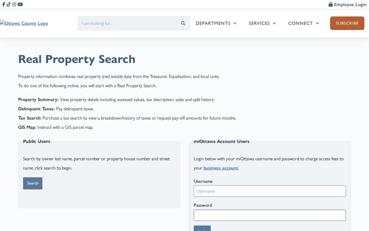
The property tools make the parcel and ZIP distinction visible before a deed or permit request is tied to the address.
USPS Checks for Georgetown ZIP Codes
USPS supplies two relevant methods: find a ZIP by address, or find all ZIPs for a city and state. Start with the street address and compare the official result with the postal city printed in the county parcel data. The Jenison Post Office is listed at 408 Chicago Drive, Jenison, MI 49428-9243. That office reference helps identify the local postal route, but it does not settle township jurisdiction or the current relationship of any person to the address.
Use a complete street number, directional, suffix, unit, and city before treating a ZIP answer as reliable. A returned result may use Jenison where a deed, tax roll, or GIS popup says Georgetown Charter Township. Preserve both values and the date checked. For an older address, add Jenisonville, Georgetown Township, South Georgetown, and nearby city labels to the record search rather than changing the USPS answer by assumption.
Finding Residents by Georgetown ZIP Code
A Georgetown Township ZIP code directory should move from postal verification to a documented record, not from a ZIP directly to a list of people. USPS ZIP Lookup has address-to-ZIP and city-and-state modes. Use it to verify the exact delivery address. Then search the property system by that address or use the PIN from the GIS popup. The voter tool takes a ZIP as part of an individual self-check, but it does not publish a ZIP-wide list of registered voters.
- Enter the full address in USPS ZIP Lookup and preserve the returned postal city and ZIP.
- Search miOttawa by house number and street name, including active or inactive parcels if an older PIN may exist.
- Compare the GIS PropertyZip, MailingZip, GovernmentUnit, and FinalPIN fields instead of treating them as interchangeable.
- Use the PIN to inspect the property summary, split history, or deeds when the question concerns the parcel.
- For election geography, ask the township clerk or use a formal QVF request by jurisdiction or precinct, not a ZIP assumption.
Michigan Voter Information Center requires a five-digit ZIP for name-search mode along with first name, last name, birth month, and birth year. The address mode instead helps a person find election information and a clerk. A formal Qualified Voter File request can select Georgetown jurisdiction, county, district, school, or precinct, but not an assumed postal zone. Its permitted fields and delivery limits follow Michigan election law and protected-address rules.
Georgetown ZIP Code Parcel History
A postal code does not provide a parcel's history. For an address that has changed form, start with the current FinalPIN, then review the county's Split History for parent and child parcels. Ottawa County documents split history back to 1975. Its historic parcel service also contains assessment snapshots beginning in 2004 through 2007. These resources can explain why an old address or PIN does not appear in a current search, but neither substitutes for a deed chain or dated household record.
When a historical PIN or legal description is found, use the deeds index by parcel, party name, liber and page, or instrument number. The current deeds page does not state an earliest online index year. If the web trail ends, the Register of Deeds research library, county counter, historic books or microfilm, Archives of Michigan, and plat records are the documented fallback channels. Match the legal description and government unit before attaching a historical record to a modern Georgetown ZIP code.
Georgetown ZIP Record Channels
Different local offices hold the records that survive a ZIP search. Ottawa County GIS and Equalization maintain the parcel and address layer. Georgetown Township keeps local zoning and building material, while the county road commission handles right-of-way matters. USPS controls delivery labels. A Georgetown building or zoning request must be made by address or parcel because no searchable public permit index was located. The residential permit application is a paper process, with township zoning review before Professional Code Inspections receives it.
When an online result is missing, contact the named custodian first, then ask to inspect the non-exempt record at the counter, library, archive, or through a Michigan FOIA request. Michigan FOIA is 1976 PA 442, MCL 15.231–15.246. Ottawa's online tracker requires an account; requests can also follow the documented county channels. Describe the address, PIN, record type, and date range. Ask for inspection before copies and request certified copies separately when needed.
For a ZIP-based research request, state whether the question concerns PropertyZip, MailingZip, or a particular street address. The basic miOttawa property form does not expose a public ZIP filter, so a countywide ZIP result should not be promised from that screen. The public parcel layer contains the ZIP attributes, and its 2,000-record maximum matters for broad GIS queries. A custodian can explain whether a map query, extract, formal data request, or individual address search is the available channel for the requested scope.
ZIP Codes Versus Georgetown Boundaries
Postal boundaries do not set township limits, property-tax jurisdiction, school district, precinct, or record custody. 49428 can be the appropriate mail code for a Georgetown Township address with a Jenison postal city, while a boundary address may require 49401, 49418, or 49426 verification. The county GIS government-unit field and the legal description are better evidence for government geography. A few regional ZIP candidates do not authorize a township-wide claim, so each address must be checked in the official tool.
- ZIP code
- The five-digit USPS delivery-routing code tied to an address or postal service area.
- ZIP+4
- An added four-digit segment that narrows delivery sorting within the five-digit ZIP.
- PO Box ZIP
- A code used for post-office boxes, which may not represent a street-delivery area.
- Carrier route
- A delivery sequence used by USPS, not a township boundary or resident directory.